

From vividly hued craters to bubbling geysers, powerful waterfalls and a serene rift valley, the classic Golden Circle tour offers visitors a tantalising glimpse of Iceland’s stunning and varied landscapes.
The day-long tour from Reykjavik takes visitors around a series of sites in south Iceland, including the Geysir Geothermal Area, the spectacular waterfall Gullfoss and historic Þingvellir National Park.
Some tours add other nearby sites, too. I booked onto a tour by Get Your Guide that also stopped at the extraordinary Kerid Crater.
I joined the tour, a coach-load of some 50 people, at a bus stop in central Reykjavik, where we met our guide for the day, a chatty, Sicilian geologist now living in Iceland.
Kerid Crater
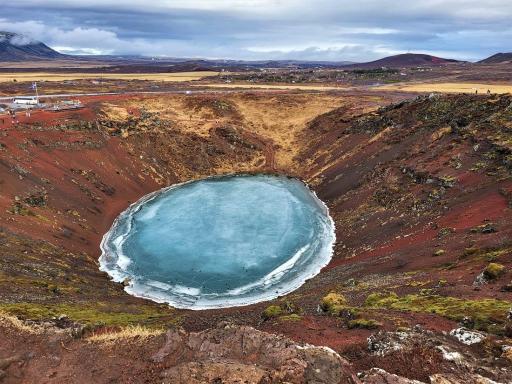
Our first stop was Kerid Crater (above), a ridiculously photogenic volcanic crater with a vivid blue lake in the centre.
Formed some 6,500 years ago when a volcanic cone collapsed, I was awestruck by the bright, colourful scene before me.
Thanks to the mix of green moss, red and black rocks, and icy blue water, it was stunningly pretty.
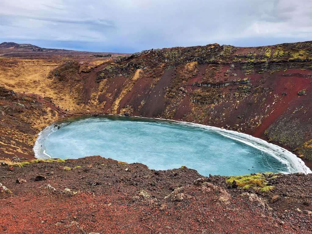
There was a path around the rim of the crater so I set off along it – taking care as it was wet, muddy and a little slippery – and stopping at the many viewpoints as I went.
I then walked down to the edge of the lake to get a closer look (below).
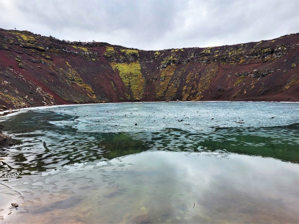
Our guide gave us 35 minutes to look around the crater. While I initially wondered how I was going to fill the time, I soon found myself going quicker than I’d have liked to make sure I got back to the coach on time.
Despite our whistlestop visit, Kerid Crater was like nothing I’d seen before. It’s an incredible, otherworldly place and I was so glad I’d chosen a tour that included it.
Geysir Geothermal Area
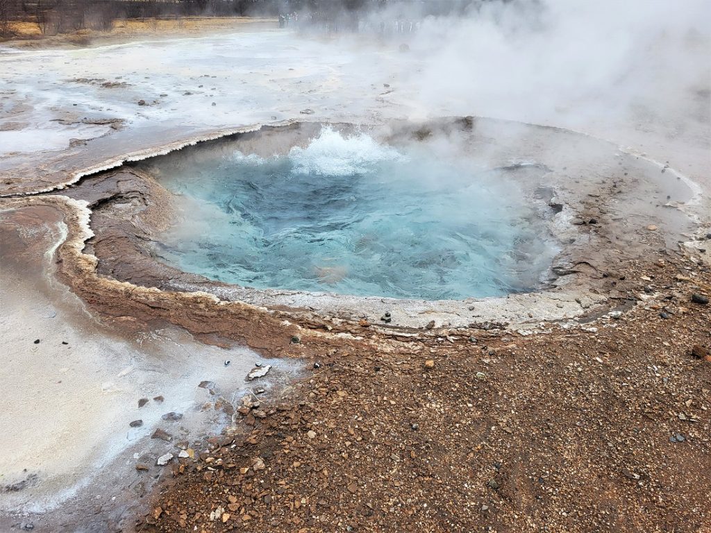
Situated in the Haukadalur Valley, the Geyser Geothermal Area extends over 3 sq km and is home to a series of geysers, all but one of which – Strokkur – is dormant.
Its most famous hot spring, the eponymous Geysir (after which geysers are named), is the most powerful, but now only erupts sporadically. The last time in 2016.
As we arrived at the large visitor centre, I found it was a lot busier than I was anticipating and I was surprised by how full the massive car park was.
On leaving the coach, I made my way to the geothermal area, which is marked by a series of trails that take visitors around the geysers.
After passing a few small, dormant geysers, it wasn’t long before I came upon the most impressive, Strokkur, which erupts every five to seven minutes.
As I approached the geyser, I found a large crowd around it, expectantly watching on for the next signs of life. We didn’t have long to wait.
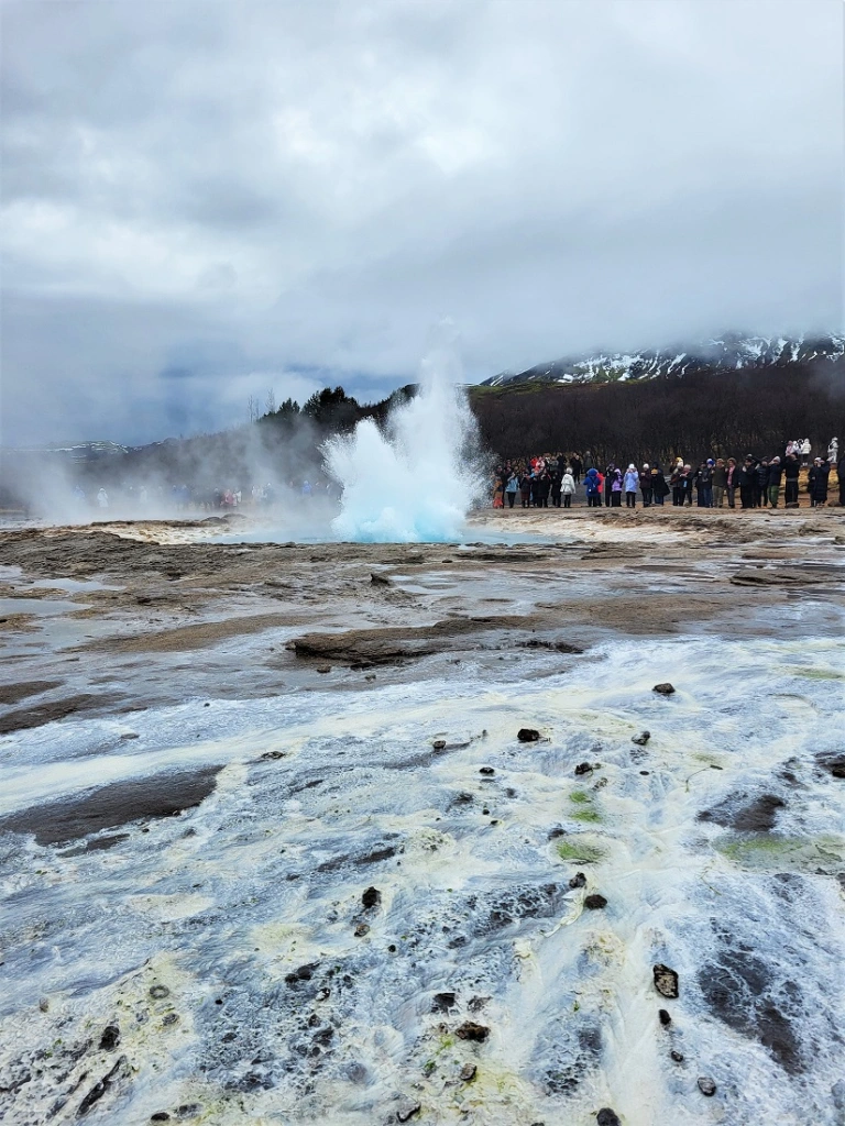
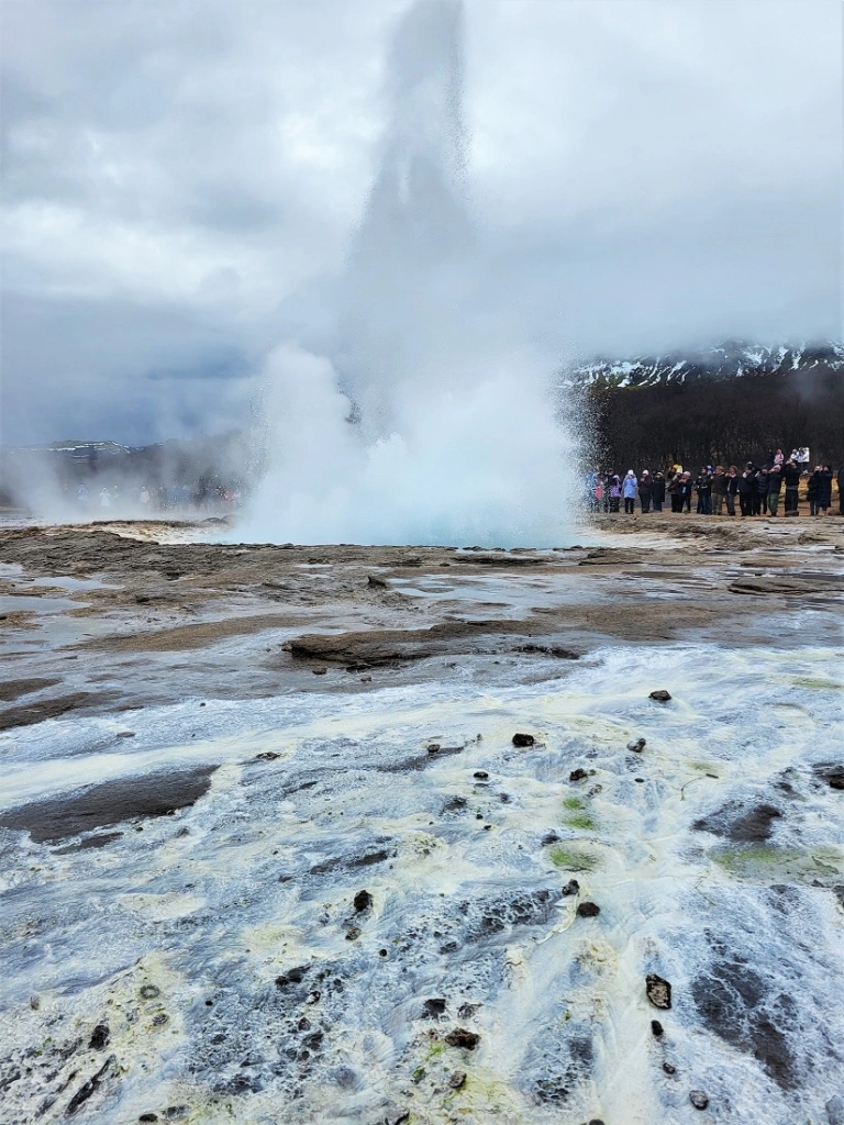
I spent a good 15 minutes watching Strokkur, during which it erupted four times, much to the crowd’s delight – two big explosions and a couple of smaller ones.
There wasn’t much warning when it blew, it would suddenly send a huge spout of water, spray and steam into the air.
It was fun watching the bubbling pool in anticipation, but the eruptions didn’t last long and I had mere seconds to take a photo.
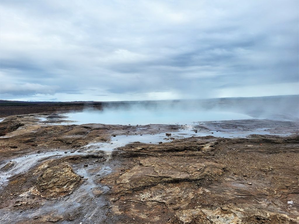
From Strokkur, I continued along the trail to the other geysers, including the gently steaming Geysir (above), and as I walked around, I occasionally caught a whiff of eggy sulphur.
Having seen all the geysers, I followed the path to a small hill overlooking the geothermal area (below).
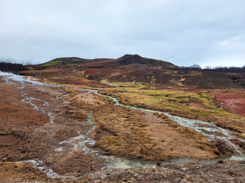
I didn’t have time to go all the way to the top, so I headed to a viewpoint partway up that looked out over a small, isolated hamlet in the neighbouring valley (below).
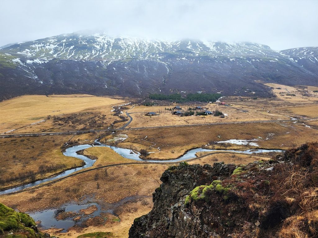
It was an idyllic scene and I was glad I’d taken the time to climb to the viewpoint.
After a quick stop to admire the view, I made my way back to the visitor centre, where it was time to move on to our next destination.
Gullfoss
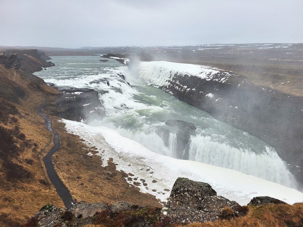
Gullfoss, which means Golden Falls (foss is Icelandic for waterfall), is a spectacular two-tier waterfall along the Hvítá River and it was our next stop, just 10 minutes’ drive from Geysir.
The waterfall is split into two sections – the upper falls (below), which drop some 11m, and the lower falls, which cascade some 21m.
I started my visit by strolling along the top of the cliffs overlooking the falls, and almost as soon as I set off, the rain started to fall heavily.
Our guide had warned us we’d be seriously impressed by Gullfoss and he wasn’t wrong.
I was blown away – they’re the most impressive I’ve seen since Victoria Falls – and I wasn’t the only person who let out a ‘Wow!’ upon laying eyes on them.
The falls are much bigger than I was expecting, and I was struck by the power and roar of the water as it tumbled over the cliffs.
It was a magnificent sight and my rainy photos don’t do justice as to how beautiful Gullfoss is.
Incredibly, Gullfoss was almost destroyed at the turn of the 20th century when a local landowner, Tómas Tómasson, handed over the rights to a company looking to build a hydroelectric dam on the Hvítá River (below).
Luckily, his daughter Sigríður launched a legal bid to stop the construction. She lost the case, but won over the court of public opinion.
The dam wasn’t built and Gullfoss was eventually given to the state.
It became a nature reserve in 1979 and Sigríður is commemorated as Iceland’s first conservationist.
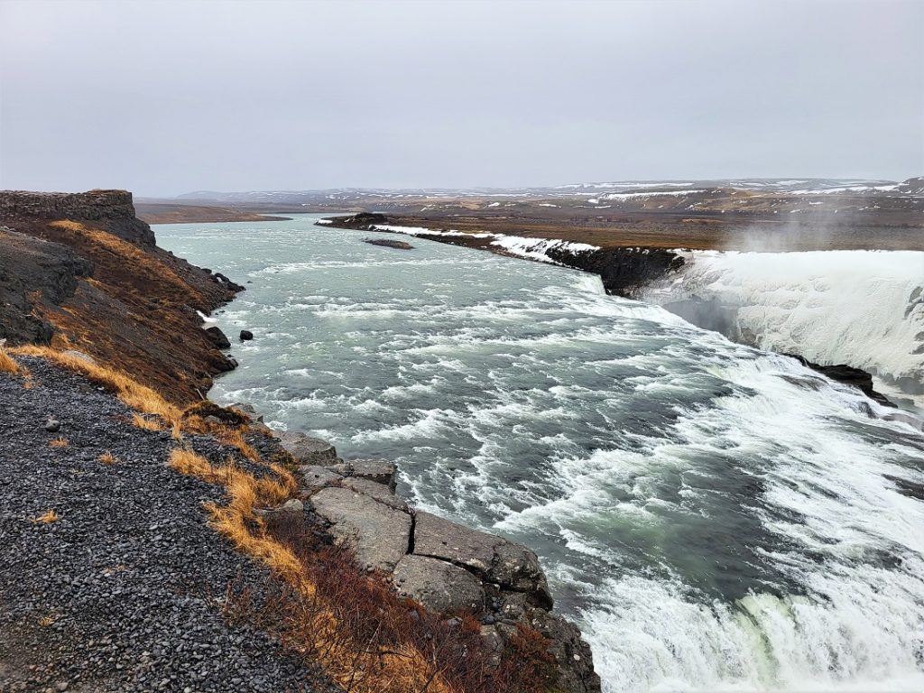
I strolled to the far end of the clifftop path to admire the waterfall from above, but I didn’t linger long as a couple of idiots had climbed over the safety rope onto the sopping wet rock to take selfies and I didn’t fancy watching any accidents.
I don’t understand why people have to be so stupid, the area’s roped off for a reason and it would have been very dangerous even in dry weather.
From the clifftop, I made my way down to the viewing point overlooking the lower falls, where I got a much closer look at them.
The view was incredible and I struggled to take my eyes off them.
Unfortunately, by now, my time at Gullfoss was almost up, so I tore myself away and arrived back at the coach just in time.
Þingvellir National Park
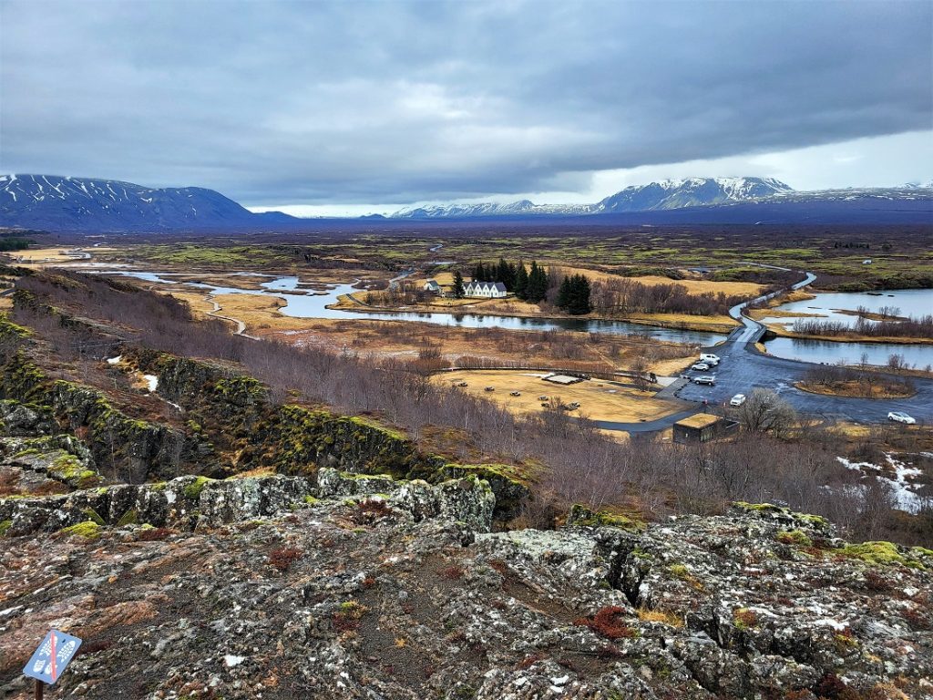
Located in Iceland’s rift valley between the North American and Eurasian tectonic plates, Þingvellir National Park is a unique and unforgettable place. So it made for a fitting end to the Golden Circle Tour.
Not only is it geologically unique, as the Mid-Atlantic rift on which it sits is the only rift in the world above sea level. It’s also a site of historic importance, as it’s where Iceland’s Parliament, the Alþingi, was born.
Þingvellir became a national park in 1930 (the first place in Iceland to be given the distinction) and in 2005, it was designated a UNESCO World Heritage Site.
We set off on the 45-minute drive to Þingvellir from Gullfoss, parking beside the small visitor centre on arrival.
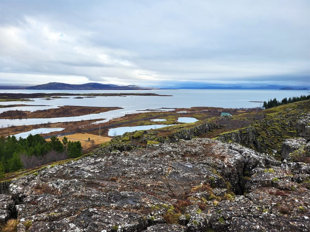
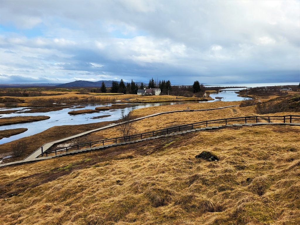
We trooped off the coach and followed our guide along one of the park’s well-marked trails, where he took us up onto a bridge that overlooks Þingvallavatn Lake (above).
The lake is renowned for being the place where visitors can snorkel and dive between the North Atlantic and Eurasian plates.
The bridge also looks out over the Icelandic Prime Minister’s summer residence (above).
The views from the bridge were incredible. It was a stunning spot and I could see why the Icelandic Prime Minister would want to spend the summer there.
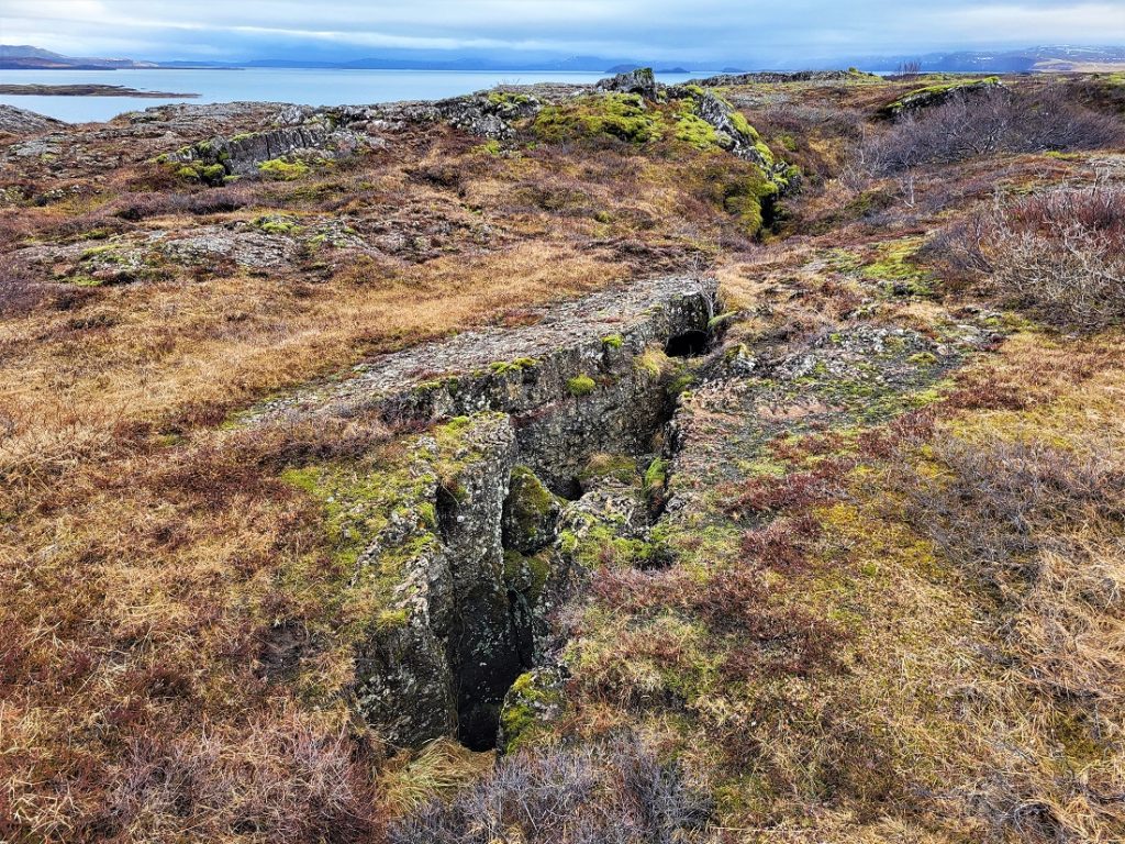
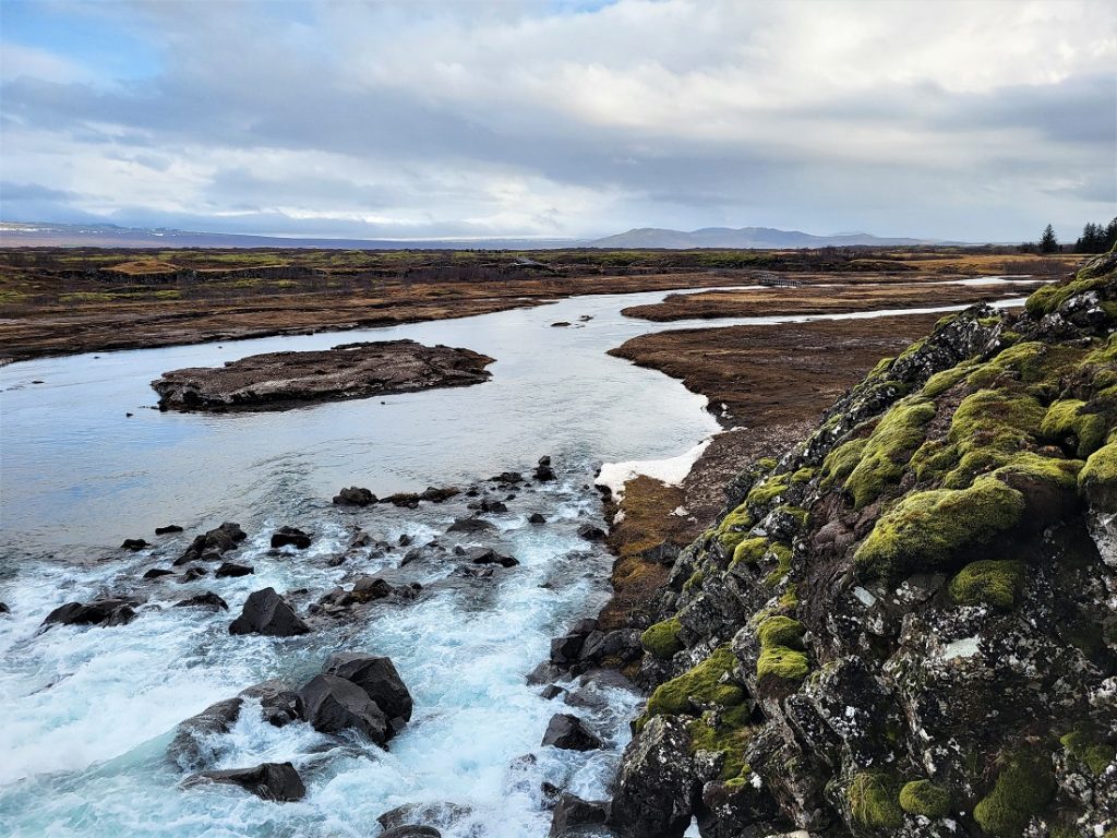
The park lies in the middle of the rift valley, where the tectonic plates are pulling apart at a rate of about 2cm a year.
As we walked around, we could see the rifts and cracks in the Earth’s crust (above). It was fascinating and very cool.
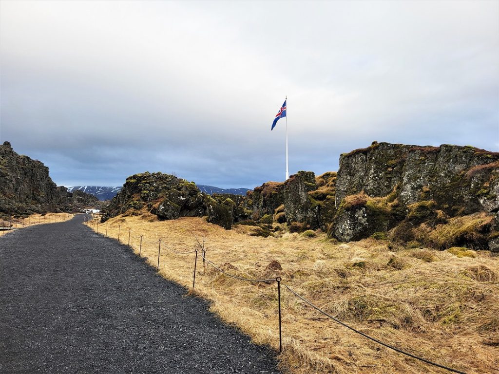
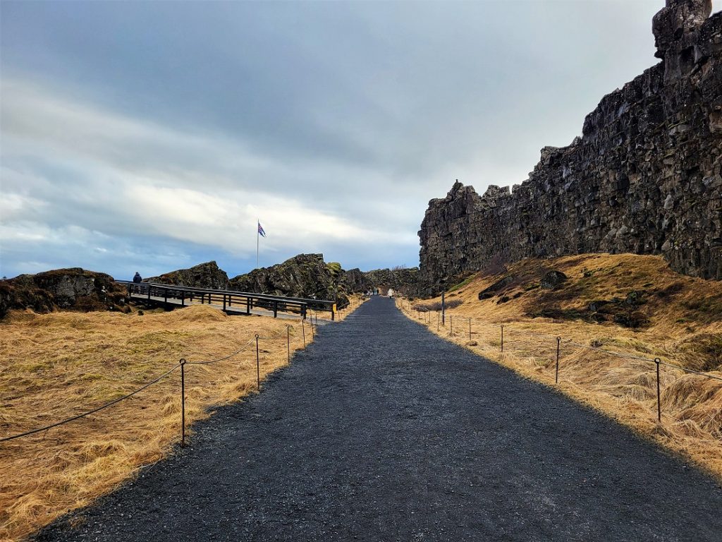
We walked down Almannagjá, a rift in the rocks that marks the edge of the North American tectonic plate (the plate is on the left above and right below), down towards where the Alþingi first met. The spot is marked by the Icelandic flag (below).
The parliament dates back to 930 when more than 30 chieftains came together for the first time, making it the world’s oldest parliament.
It was such a success, the chieftains decided to make it an annual event where they discussed laws, networked, and tried and punished criminals. The Alþingi continued to meet at Þingvellir until 1798.
We walked up to the viewing platform near the site of the Alþingi, where we had a better, closer look at the Prime Minister’s residence (above).
There, I left the group and continued down the path as far as the Öxará River (below), which was diverted in the 10th century to provide water for the Alþingi.
I spent some time watching the Öxaráfoss, which was in full flow with water thundering over the rocks.
My time at Þingvellir was almost up, so I (quite literally) ran back to the car park, where I made it to the coach in the nick of time.
The 45 minutes we had at the park was far too short to do Þingvellir justice and there was a lot I didn’t get to see.
I’d like to go back to properly explore it, as it’s a marvellous place and the geology, in particular, is out of this world.
General thoughts
I enjoyed the Golden Circle tour. We visited some breathtaking and unusual places during the eight-hour trip, and it gave me a taste of Iceland’s many natural wonders.
The only downside was how busy some of the sites were. It’s completely understandable as the Golden Circle is a major tourist destination, but it was difficult to see everything at each location given how tight our schedule was.
It would have been nice if we’d had a little longer at each site to ease the pressure, as I found I was so concerned about making sure I wasn’t late for the coach, I couldn’t fully relax and enjoy each of the places we visited.


